Order Total (1 Item Items):
Shipping Destination:

9781908402134 - New Edition Bradshaw Railway Map 1907 by George Bradshaw (31 results)
Skip to main search results
Product Type
- All Product Types
- Books (28)
- Magazines & Periodicals
- Comics
- Sheet Music
- Art, Prints & Posters
- Photographs
- Maps (3)
- Manuscripts & Paper Collectibles
Condition
Binding
- All Bindings
- Hardcover
- Softcover (9)
Collectible Attributes
- First Edition
- Signed
- Dust Jacket (1)
- Seller-Supplied Images (10)
- Not Print on Demand (31)
Free Shipping
Seller Location
Seller Rating
-
Bradshaw's Railway Folded Map 1907
Published by Old House Books, 2011
ISBN 10: 190840213XISBN 13: 9781908402134
Book
Paperback. Condition: Good. The book has been read but remains in clean condition. All pages are intact and the cover is intact. Some minor wear to the spine.
-

Bradshaw's Railway Folded Map 1907
Published by Old House Books, 2011
ISBN 10: 190840213XISBN 13: 9781908402134
Book
Condition: Good. Most items will be dispatched the same or the next working day.
-
Bradshaw's Railway Folded Map 1907
Published by Old House Books, 2011
ISBN 10: 190840213XISBN 13: 9781908402134
Book
Condition: VeryGood. Most items will be dispatched the same or the next working day.
-
Bradshaw's Railway Folded Map 1907
Published by Bloomsbury Publishing PLC, United Kingdom, London, 2011
ISBN 10: 190840213XISBN 13: 9781908402134
Book
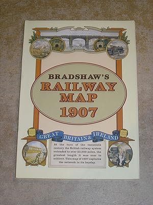
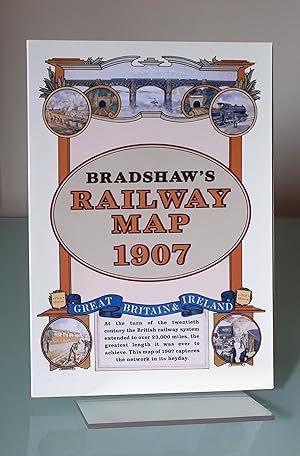
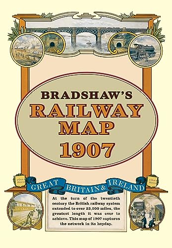
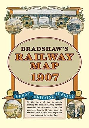
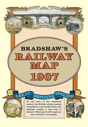
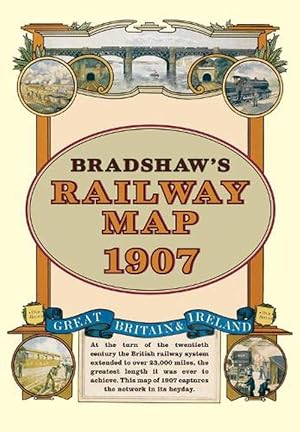
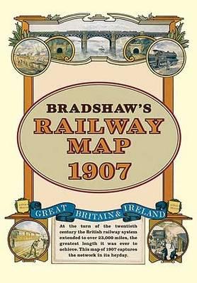
Paperback. Condition: Very Good. At the turn of the 20th century the rail network extended to over 23,000 miles, very nearly the circumference of the world the greatest length it was ever to achieve. Some urban routes had closed and later, hundreds of rural lines and stations succumbed to the Beeching axe. This map shows the network in its heyday before the decline commenced. The book has been read, but is in excellent condition. Pages are intact and not marred by notes or highlighting. The spine remains undamaged.
-
New Edition Bradshaw Railway Map 1907
Published by Old House Books, 2011
ISBN 10: 190840213XISBN 13: 9781908402134
Book
Condition: Acceptable. Item in good condition. Textbooks may not include supplemental items i.e. CDs, access codes etc.
-
Bradshaw's Railway Folded Map 1907 (Map)
Published by Bloomsbury Publishing PLC, London, 2011
ISBN 10: 190840213XISBN 13: 9781908402134
Book
Map. Condition: new. Map. At the turn of the 20th century the rail network extended to over 23,000 miles, very nearly the circumference of the world the greatest length it was ever to achieve. Some urban routes had closed and later, hundreds of rural lines and stations succumbed to the Beeching axe. This map shows the network in its heyday before the decline commenced. At the turn of the 20th century the rail network extended to over 23,000 miles, very nearly the circumference of the world - the greatest length it was ever to achieve. Some urban routes had closed and later, hundreds of rural lines and stations succumbed to the Beeching axe. This title shows the network in its heyday before the decline commenced. Shipping may be from multiple locations in the US or from the UK, depending on stock availability.
-
Bradshaw's Railway Folded Map 1907
Published by Bloomsbury Publishing PLC, 2011
ISBN 10: 190840213XISBN 13: 9781908402134
Book
UNK. Condition: New. New Book. Shipped from UK. Established seller since 2000.
-
![Seller image for Bradshaw's Railway Folded Map 1907 by Bradshaw, George [Map ] for sale by booksXpress](https://pictures.abebooks.com/inventory/md/md31856453031.jpg)
Bradshaw's Railway Folded Map 1907 by Bradshaw, George [Map ]
Published by Osprey Publishing, 2011
ISBN 10: 190840213XISBN 13: 9781908402134
Book
No Binding. Condition: new.
-
Bradshaw's Railway Folded Map 1907
Published by Bloomsbury Publishing (UK) 2011-11-21, Oxford, 2011
ISBN 10: 190840213XISBN 13: 9781908402134
Book
sheet map. Condition: New. Language: ENG.
-
Bradshaws Railway Folded Map 1907 (Old House)
Published by Old House Books, 2011
ISBN 10: 190840213XISBN 13: 9781908402134
Book
Map. Condition: Used; Very Good. ***Simply Brit*** Welcome to our online used book store, where affordability meets great quality. Dive into a world of captivating reads without breaking the bank. We take pride in offering a wide selection of used books, from classics to hidden gems, ensuring there is something for every literary palate. All orders are shipped within 24 hours and our lightning fast-delivery within 48 hours coupled with our prompt customer service ensures a smooth journey from ordering to delivery. Discover the joy of reading with us, your trusted source for affordable books that do not compromise on quality.
-
Bradshaw's Railway Folded Map 1907
Published by Old House Books, 2011
ISBN 10: 190840213XISBN 13: 9781908402134
Book
map. Condition: Very Good. **PAPERBACK**.
-
Bradshaw's Railway Map 1907
Published by Old House, Oxford, 2011
ISBN 10: 190840213XISBN 13: 9781908402134
Book
Soft cover. Condition: As New. Dust Jacket Condition: As New. An as new copy of the facsimile edition of Bradshaw's 1907 Railway Map, in a card slipcase with a commentary. Conditionn is as new and the map shows no sign of having been unfolded.
-
Bradshaw's Railway Folded Map 1907 (Old House)
Published by Old House Books, 2011
ISBN 10: 190840213XISBN 13: 9781908402134
Book
Condition: New.
-
BRADSHAW'S RAILWAY FOLDED MAP1907
Published by Osprey, 2011
ISBN 10: 190840213XISBN 13: 9781908402134
Map
Other cartographic. Condition: Brand New. 1 pages. 8.27x5.91x0.28 inches. In Stock.
-
Bradshaw's Railway Folded Map 1907
Published by Old House Books, 2011
ISBN 10: 190840213XISBN 13: 9781908402134
Book
Soft cover. Condition: Good. No Jacket. Slipcase + Map, some light wear to edges and corners of slipcase, map in good condition, one corner and edge creased.
-
Bradshaw's Railway Folded Map 1907
Published by Bloomsbury Publishing PLC, 2011
ISBN 10: 190840213XISBN 13: 9781908402134
Book
Sheet map. Condition: New. New copy - Usually dispatched within 4 working days. At the turn of the 20th century the rail network extended to over 23,000 miles, very nearly the circumference of the world - the greatest length it was ever to achieve. Some urban routes had closed and later, hundreds of rural lines and stations succumbed to the Beeching axe. This title shows the network in its heyday before the decline commenced.
-
Bradshaw's Railway Folded Map 1907 (Old House)
Published by Old House Books, 2011
ISBN 10: 190840213XISBN 13: 9781908402134
Book
Paperback. Condition: New. BRAND NEW ** SUPER FAST SHIPPING FROM UK WAREHOUSE ** 30 DAY MONEY BACK GUARANTEE.
-
New Edition Bradshaw Railway Map 1907
Published by Old House Books, 2011
ISBN 10: 190840213XISBN 13: 9781908402134
Book
Condition: New. In English.
-
Bradshaw's Railway Folded Map 1907 (Old House)
Published by Old House Books, 2011
ISBN 10: 190840213XISBN 13: 9781908402134
Book
Condition: New. At the turn of the 20th century the rail network extended to over 23,000 miles, very nearly the circumference of the world - the greatest length it was ever to achieve. Some urban routes had closed and later, hundreds of rural lines and stations succumbed to the Beeching axe. This title shows the network in its heyday before the decline commenced. Series: Old House. BIC Classification: HBTP1; WGF; WQN. Category: (G) General (US: Trade). Dimension: 209 x 150 x 7. Weight in Grams: 124. New. 2011. Facsimile map. Map. . . . . Books ship from the US and Ireland.
-
Bradshaw's Railway Map 1907; Great Britain & Ireland
Published by Old House Books
ISBN 10: 190840213XISBN 13: 9781908402134
Map
Soft cover. Condition: Very Good. Large format map depicting the railways of Great Britain & Ireland. The Fold out Map is in very good condition, with no rips or tears. Free Postage within the UK.
-
Bradshaw's Railway Folded Map 1907 (Old House)
Published by Old House Books, 2011
ISBN 10: 190840213XISBN 13: 9781908402134
Book
Condition: New. At the turn of the 20th century the rail network extended to over 23,000 miles, very nearly the circumference of the world - the greatest length it was ever to achieve. Some urban routes had closed and later, hundreds of rural lines and stations succumbed to the Beeching axe. This title shows the network in its heyday before the decline commenced. Series: Old House. BIC Classification: HBTP1; WGF; WQN. Category: (G) General (US: Trade). Dimension: 209 x 150 x 7. Weight in Grams: 124. New. 2011. Facsimile map. Map. . . . .
-
Bradshaw's Railway Folded Map 1907
Published by Old House Books, 2011
ISBN 10: 190840213XISBN 13: 9781908402134
Book
Paperback map. Condition: Good. Wear present.Discolouration present.Fold creasing present.Foxing.Scruff marks and small marks present on the front cover and back cover.Scruff mark present at the sides of pages.Small mark present on a few pages. Tearing present.Dent marks and small stain marks present on the front and back cover.
-
New Edition Bradshaw Railway Map 1907
Published by Old House Books, 2011
ISBN 10: 190840213XISBN 13: 9781908402134
Book
Condition: new.
-
Bradshaw's Railway Folded Map 1907
Published by Old House Books, 2011
ISBN 10: 190840213XISBN 13: 9781908402134
Book
Soft cover. Condition: As New. Facsimile of large folded map from 1907 by George Bradshaw contained in a sleeve with paper covers & 2 pages of text by Geoffrey Kitchenside. Seems unused & unread. No inscription or ownership markings. No tears or loss.
-
Bradshaw's Railway Folded Map 1907 [Map] Bradshaw, George
Published by Old House Books, 2011
ISBN 10: 190840213XISBN 13: 9781908402134
Map
map. Condition: Good. Wear present.Discolouration present.Fold creasing present.Foxing.Scruff marks and small marks present on the front cover and back cover.Scruff mark present at the sides of pages.Small mark present on a few pages.
-
Bradshaw's Railway Folded Map 1907
Published by Bloomsbury Publishing PLC, 2011
ISBN 10: 190840213XISBN 13: 9781908402134
Book
UNK. Condition: New. New Book. Shipped from UK. Established seller since 2000.
-

Bradshaw's Railway Folded Map 1907
Published by Bloomsbury Publishing PLC, 2011
ISBN 10: 190840213XISBN 13: 9781908402134
Book
Landkarte. Condition: Neu. Neu neuware, importqualit�t, auf lager.
-

Bradshaw's Railway Folded Map 1907 (Map)
Published by Bloomsbury Publishing PLC, London, 2011
ISBN 10: 190840213XISBN 13: 9781908402134
Book
Map. Condition: new. Map. At the turn of the 20th century the rail network extended to over 23,000 miles, very nearly the circumference of the world the greatest length it was ever to achieve. Some urban routes had closed and later, hundreds of rural lines and stations succumbed to the Beeching axe. This map shows the network in its heyday before the decline commenced. At the turn of the 20th century the rail network extended to over 23,000 miles, very nearly the circumference of the world - the greatest length it was ever to achieve. Some urban routes had closed and later, hundreds of rural lines and stations succumbed to the Beeching axe. This title shows the network in its heyday before the decline commenced. Shipping may be from our Sydney, NSW warehouse or from our UK or US warehouse, depending on stock availability.
-
Bradshaw's Railway Folded Map 1907 (Map)
Published by Bloomsbury Publishing PLC, London, 2011
ISBN 10: 190840213XISBN 13: 9781908402134
Book
Map. Condition: new. Map. At the turn of the 20th century the rail network extended to over 23,000 miles, very nearly the circumference of the world the greatest length it was ever to achieve. Some urban routes had closed and later, hundreds of rural lines and stations succumbed to the Beeching axe. This map shows the network in its heyday before the decline commenced. At the turn of the 20th century the rail network extended to over 23,000 miles, very nearly the circumference of the world - the greatest length it was ever to achieve. Some urban routes had closed and later, hundreds of rural lines and stations succumbed to the Beeching axe. This title shows the network in its heyday before the decline commenced. Shipping may be from our UK warehouse or from our Australian or US warehouses, depending on stock availability.
-
Bradshaw\ s Railway Folded Map 1907
Published by Bloomsbury Publishing PLC, 2011
ISBN 10: 190840213XISBN 13: 9781908402134
Book
Condition: New. At the turn of the 20th century the rail network extended to over 23,000 miles, very nearly the circumference of the world - the greatest length it was ever to achieve. Some urban routes had closed and later, hundreds of rural lines and stations succumbed t.