Items related to Mammoth Hot Springs: Yellowstone National Park NW (National...
Mammoth Hot Springs: Yellowstone National Park NW (National Geographic Trails Illustrated Map) (National Geographic Trails Illustrated Map, 303)
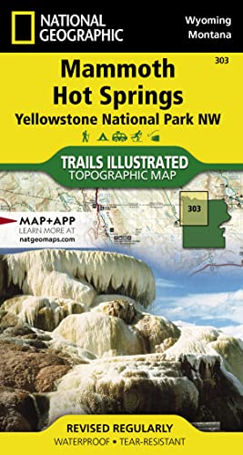

� Waterproof � Tear-Resistant � Topographic Map
National Geographic's Trails Illustrated map of the Mammoth Hot Springs area of Yellowstone National Park is designed to meet the needs of outdoor enthusiasts with unmatched detail of the north-west section of the national park. Expertly researched and created in partnership with local land management agencies, this map features key points of interest including the Mammoth Hot Springs area, Canyon Village, South Entrance Station, West Yellowstone, Upper Yellowstone Falls, Gallatin National Forest, Absaroka-Beartooth Wilderness, and Lee Metcalf Wilderness.
With many miles of mapped trails and marked Bear Management Zones the Mammoth Hot Springs map can guide you off the beaten path and back again. The clearly marked trails include mileages between intersections. The map base includes contour lines and elevations for summits, passes and many lakes. Some of the many recreation features include: visitor centers, campgrounds, trailheads, boat ramps, and interpretive trails.
Every Trails Illustrated map is printed on "Backcountry Tough" waterproof, tear-resistant paper. A full UTM grid is printed on the map to aid with GPS navigation.
Other features found on this map include: Absaroka-Beartooth Wilderness, Crowfoot Ridge, Gallatin National Forest, Grouse Mountain, Lee Metcalf Wilderness, Lower Falls of the Yellowstone River, Mount Holmes, Ramshorn Peak, Yellowstone National Park.
- Map Scale = 1:70,000
- Sheet Size = 37.75" x 25.5"
- Folded Size = 4" x 7.5"
"synopsis" may belong to another edition of this title.
About the Author:
Founded in 1915 as the Cartographic Group, the first division of National Geographic, National Geographic Maps has been responsible for illustrating the world around us through the art and science of mapmaking.Today, National Geographic Maps continues this mission by creating the world's best wall maps, recreation maps, atlases, and globes which inspire people to care about and explore their world.
"About this title" may belong to another edition of this title.
- PublisherNational Geographic Society
- Publication date2019
- ISBN 10 1566954347
- ISBN 13 9781566954341
- BindingMap
- Number of pages2
Buy New
Learn more about this copy
US$ 12.93
Shipping:
FREE
Within U.S.A.
Top Search Results from the AbeBooks Marketplace
Stock Image
Mammoth Hot Springs, Wyoming/Montana, USA (Trails Illustrated 303)
Published by
National Geographic Society
(2009)
ISBN 10: 1566954347
ISBN 13: 9781566954341
New
Quantity: 1
Seller:
Rating
Book Description Map. Condition: New. Seller Inventory # DADAX1566954347
Buy New
US$ 12.93
Convert currency
Stock Image
Yellowstone Nw/mammoth Hot Springs (Folded)
Published by
National Geographic Maps, Evergreen
(2013)
ISBN 10: 1566954347
ISBN 13: 9781566954341
New
Quantity: 1
Seller:
Rating
Book Description Folded. Condition: new. Folded. National Geographic's Trails Illustrated Maps are the most detailed and up-to-date topographic recreation maps available for US National Parks, National Forests and other popular outdoor recreation areas. A necessity for exploring the outdoors, each map is printed on waterproof, tear-resistant material. They also contain key safety and contact information, GPS and compass coordinates, Leave No Trace ethical guidelines and hundreds of points-of-interest, including scenic viewpoints, campgrounds, boat launches, swimming areas, marine sanctuaries and wildlife refuges. Coverage of the Old Faithful area of Yellowstone National Park includes Heart Lake BMA, Pitchstone Plateau, Bechler Ranger Station, South Entrance, Teton Wilderness, John D. Rockefeller Jr Memorial Parkway, Jedediah Smith Wilderness, Winegar Hole Wilderness, Bechler Canyon, Cascade Corner, Firehole BMA, Shoshone Lake, Western half of Yellowstone Lake. Includes UTM grids for use with your GPS unit. Shipping may be from multiple locations in the US or from the UK, depending on stock availability. Seller Inventory # 9781566954341
Buy New
US$ 19.94
Convert currency
Stock Image
Mammoth Hot Springs 303 ng Yellowstone NP NW National Geographic Trails Illustrated Map Trails Illustrated National Parks
Published by
National Geographic Maps
(2013)
ISBN 10: 1566954347
ISBN 13: 9781566954341
New
Quantity: 3
Seller:
Rating
Book Description UNK. Condition: New. New Book. Shipped from UK. Established seller since 2000. Seller Inventory # EA-9781566954341
Buy New
US$ 20.97
Convert currency
Stock Image
Yellowstone Nw/mammoth Hot Springs
Published by
National Geographic Maps Division 2013-09-26, Washington, D.C.
(2013)
ISBN 10: 1566954347
ISBN 13: 9781566954341
New
Quantity: 1
Seller:
Rating
Book Description sheet map (folded). Condition: New. Language: ENG. Seller Inventory # 9781566954341
Buy New
US$ 15.77
Convert currency
Stock Image
Mammoth Hot Springs: Yellowstone National Park NW (National Geographic Trails Illustrated Map) (National Geographic Trails Illustrated Map, 303)
Published by
National Geographic Society
(2019)
ISBN 10: 1566954347
ISBN 13: 9781566954341
New
Paperback
Quantity: 1
Seller:
Rating
Book Description Paperback. Condition: new. Buy for Great customer experience. Seller Inventory # GoldenDragon1566954347
Buy New
US$ 22.40
Convert currency
Stock Image
Mammoth Hot Springs: Yellowstone National Park NW (National Geographic Trails Illustrated Map) (National Geographic Trails Illustrated Map, 303)
Published by
National Geographic Society
(2019)
ISBN 10: 1566954347
ISBN 13: 9781566954341
New
Quantity: 1
Seller:
Rating
Book Description Condition: New. Book is in NEW condition. 0.2. Seller Inventory # 1566954347-2-1
Buy New
US$ 29.20
Convert currency
Stock Image
Mammoth Hot Springs: Yellowstone National Park NW (National Geographic Trails Illustrated Map) (National Geographic Trails Illustrated Map, 303)
Published by
National Geographic Society
(2019)
ISBN 10: 1566954347
ISBN 13: 9781566954341
New
Paperback
Quantity: 1
Seller:
Rating
Book Description Paperback. Condition: new. New. Seller Inventory # Wizard1566954347
Buy New
US$ 25.74
Convert currency
Stock Image
Yellowstone Nw/mammoth Hot Springs: Trails Illustrated National Parks
Published by
National Geographic Maps
(2019)
ISBN 10: 1566954347
ISBN 13: 9781566954341
New
Quantity: 7
Seller:
Rating
Book Description Sheet map, folded. Condition: New. New copy - Usually dispatched within 4 working days. Seller Inventory # B9781566954341
Buy New
US$ 18.03
Convert currency
Stock Image
Mammoth Hot Springs: Yellowstone National Park NW (National Geographic Trails Illustrated Map) (National Geographic Trails Illustrated Map, 303)
Published by
National Geographic Society
(2019)
ISBN 10: 1566954347
ISBN 13: 9781566954341
New
Paperback
Quantity: 1
Seller:
Rating
Book Description Paperback. Condition: new. New Copy. Customer Service Guaranteed. Seller Inventory # think1566954347
Buy New
US$ 28.34
Convert currency
Stock Image
Mammoth Hot Springs: Yellowstone National Park NW (National Geographic Trails Illustrated Map) (National Geographic Trails Illustrated Map, 303)
Published by
National Geographic Maps
(2019)
ISBN 10: 1566954347
ISBN 13: 9781566954341
New
Quantity: 1
Seller:
Rating
Book Description Condition: new. Seller Inventory # FrontCover1566954347
Buy New
US$ 29.52
Convert currency